

Pond Facts & Map
Pillings Pond Foundation, Inc. — 501(c)(3) — Lynnfield, Massachusetts
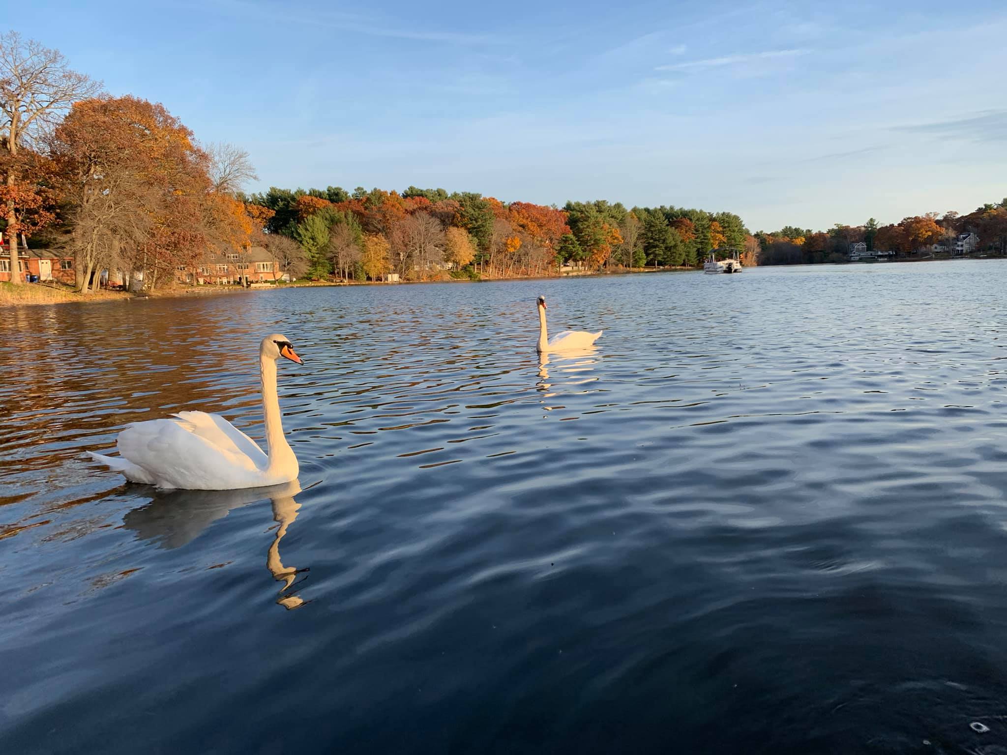
About Pillings Pond
Pillings Pond is a shallow, 96-acre artificial impoundment located about a mile southeast of Lynnfield center. Created in the 1830s by damming Bates Brook, the pond is a popular neighborhood focal point for fishing, ice-fishing, and wildlife viewing, though it struggles with invasive weeds and algae blooms.
🏖 Size
Approximately 96 acres
🏠 Location
~1 mile southeast of Lynnfield center
🐥 Depth
Shallow: 2′ to 5′ in most areas
Deep end: 25 feet
📈 Water Quality
Monitored annually
Summer 2025: Excellent
🌿 Origin
Created in the 1830s by damming Bates Brook
⛴ Public Access
Boat launch (west shore)
Rotary Park — Summer Street
Recreation & Fishing
Pillings Pond is a beloved recreational destination for Lynnfield residents year-round. We encourage all residents to get out on the water and enjoy everything the pond has to offer.
Fishing
The shallow waters make Pillings Pond an excellent spot for panfish (including yellow perch and black crappie) as well as largemouth bass. Ice fishing is also popular during winter months. We encourage catch and release fishing to preserve the pond's ecosystem.
Rotary Park
Located on Summer Street, Rotary Park is the primary public access point for Pillings Pond. It features 7 parking spaces, a fishing dock, benches, and a lawned area along the shoreline — perfect for fishing, picnicking, and wildlife watching.
Kayaking & Canoeing
Pillings Pond is a wonderful spot to kayak, canoe, or paddleboard. The pond's natural beauty, abundant wildlife, and calm waters make it an ideal paddling destination for all skill levels. Launch from the public boat launch or Rotary Park.
Boating on Pillings Pond
Boating is allowed on Pillings Pond. All boats must be registered with the Town of Lynnfield. Due to the narrowness of the pond and shoreline erosion prevention, Pillings Pond is a no-wake zone. All Massachusetts Boating Laws apply.
Please be a good steward of the pond and follow these guidelines to keep Pillings Pond safe, clean, and enjoyable for everyone:
Pillings Pond Map
The map below shows key features of the pond including depths, hazard areas, rocks, sandbars, the boat launch, and Rotary Park.
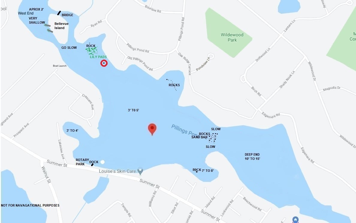
Map for reference only — not for navigational purposes. April 2021.
Water Quality
The Pillings Pond Foundation actively monitors and works to improve water quality. We partner with professional water management companies and are pursuing grant funding for additional improvements including SolarBee aerator systems.
2025 Water Quality Results
Water quality monitoring in July and August 2025 showed excellent conditions. The Foundation continues working with Water and Wetland Company on year-end reporting and long-term improvement strategies.
Excellent — Summer 2025MA State Water Quality Improvement Grant
PPF is pursuing the Massachusetts State Water Quality Improvement Grant for Spring 2026 to fund additional water quality improvements for Pillings Pond.
Grant Pending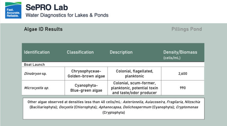
SePRO Lab water diagnostics — Pillings Pond algae identification results.